


Colorado Springs City Council adds support for expanding Cheyenne Mountain State Park
Public land is closer to expanding around the Pikes Peak region’s second most famous mountain.
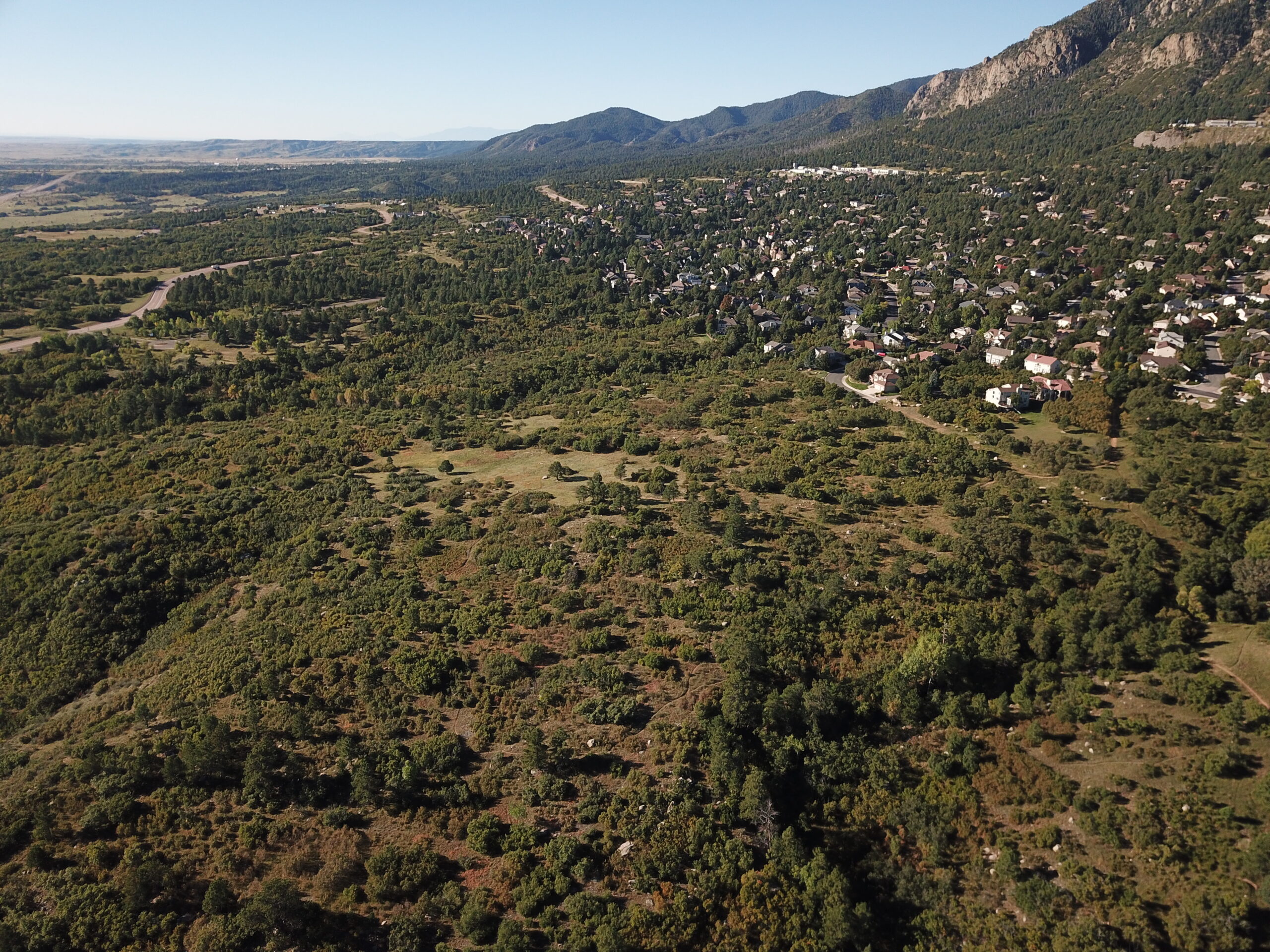
Colorado Springs’ City Council on Tuesday unanimously approved the Trails, Open Space and Parks (TOPS) fund spending $4.1 million toward a major expansion of Cheyenne Mountain State Park. That money would acquire an upper 130 acres to be overseen by park-managing Colorado Parks and Wildlife, which would pursue buying a larger tract below ー about 350 acres of rolling grass, oak and pine seen off Colorado 115 entering the park.
The land has been blueprinted for 95 single-family homes under the JL Ranch master plan, TOPS Manager Lonna Thelen has shown in past presentations to the TOPS Working Committee and Parks Board, which both previously approved the purchase. For efficiency, the Trust for Public Land would acquire both parcels totaling about 480 acres and sell back to the city and state.
“The city continues to grow and grow very quickly, and these are very strategic parcels, and we need to be able to act quickly to secure them so we can keep the city that amazing place to live, work and play,” the Trust for Public Land’s Jim Petterson said in a previous Gazette interview.
He spoke to the value of “that gateway to the state park” as well as a “buffer” for development between Fort Carson in one direction and Cheyenne Mountain Space Force Station in the other direction, reached from the road that flanks the upper 130 acres. As requested by the City Council, Thelen has provided letters of support from leadership at Fort Carson and Cheyenne Mountain Space Force Station.
Speaking to the latter: “We’re looking for continued collaboration with them in the future,” Thelen said.
That’s as city Parks officials have eyed a crossing for a future segment of the Chamberlain Trail, the long-dreamed trail touring the foothills north to south between Blodgett Peak and Cheyenne Mountain.

The idea is for a southern-most stretch to travel from Fishers Canyon Open Space ー the adjacent preserve yet to open after master planning this year ー through the newly acquired terrain and on to Cheyenne Mountain. That would require military approval for the trail to cross NORAD Road.
“We have begun the conversation of a trail crossing,” Thelen said. “We’re hopeful that we would be able to get across NORAD Road at some location.”
Medicine Wheel Trail Advocates Executive Director Cory Sutela indeed sees the potential for Chamberlain Trail. But “my hope is we’d be able to add some other interesting trails in there, not just Chamberlain,” he said in a previous interview.
Colorado Parks and Wildlife has not indicated any plans for the roughly 480 acres that might represent the state park’s most significant expansion since upper parts of Cheyenne Mountain were acquired between 2007 and 2009.
Said Southeast Region Manager Frank McGee in a statement: “While it would be premature to provide specifics, Colorado Parks and Wildlife is always looking to the future in terms of conservation and recreation. It takes years of forethought and planning alongside community partners for any effort to come to fruition.”
Advocates see planning still in need for city-acquired land that grew the state park to the south, around Rock Creek. TOPS acquisitions over the years culminated with 163 acres bought in 2019 for $1.3 million.
“That was 2019, six years ago, and there is no public access to those parcels,” advocate Carol Beckman pointed out at this month’s Parks Board meeting.
Parks Director Britt Haley recognized the need. “Now we have this opportunity come along, and now we can do it in one effort,” she said.
The acquisition would follow a trend in the history of Cheyenne Mountain State Park, which was established in 2000 on formerly private property purchased in part by the city’s Trails, Open Space and Parks sales tax fund that was created a few years prior to preserve land. Today, about 60% of the state park is on acreage bought by the city.
“This allows the city to use our strength in acquisition as well as CPW to use their strength in enforcement and management,” Thelen said.
But in a park requiring a fee to enter, some have wondered if tax-paying residents should have to pay to access city-owned land.
Drivers have needed a pass, but people on foot and bike have entered for free, TOPS Senior Administrator David Deitemeyer said at the past Parks Board meeting. “We anticipate that will continue with this portion of the property,” he said.
The acquisition requires a second vote by the City Council, set for Dec. 9.