


Squeeze a late fall exploration into the Sawatch mountains | Take a Hike

The CT Series is a special series of hiking articles about the Colorado Trail (CT) that runs from May through October. The CT is a unique and well maintained continuous trail, spanning 485 miles from Denver to Durango. The Colorado Mountain Club Guidebook to the Colorado Trail is an indispensable tool for planning and executing trail excursions. The book divides the CT into 28 segments of varying length. The Colorado Trail Foundation website (coloradotrail.org) also has a ton of useful information.
Before winter moves in, this CT section stays below 10,000 feet and allows for an October exploration into the Sawatch Range. The trailhead parking area is rather small but should not be too crowded later in the fall season. From Buena Vista, drive north on Highway 24 for about 17 miles to County Rd. 390 aka Clear Creek Road and turn left. Drive for about 2.5 miles past Clear Creek Reservoir to a group of large boulders on the left side that mark the trailhead parking lot, just beyond a campground area.

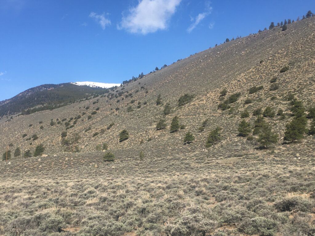
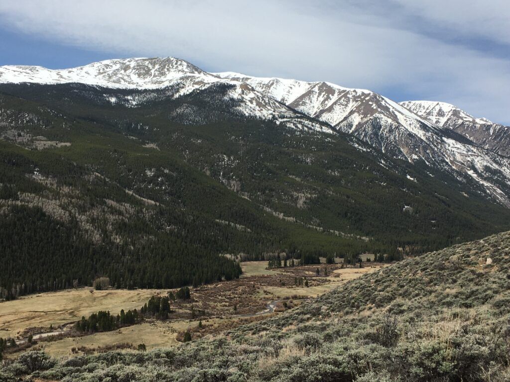
Cross the road and begin hiking northward through sagebrush shrubland then swing westward, climbing a long sunny ridge. The extended shrubby hillside is ideal habitat for the green-tailed towhee. They arrive in mid-May and during summer their trilly and buzzy song fills the air, but by October they have vacated the area, heading south for the winter. From the ridge the lovely Clear Creek Valley sprawls below to the south, with the snowy 13ers Quail Mountain and Mount Hope perched above the valley. Climb steadily up the ridge for about 1.5 miles then swing northward on flatter terrain.
Follow a dirt road along a powerline for about a half mile then veer left away from the powerline at the CT signage. Progress through a wet valley lined with aspen groves and full of willows. The landscape shifts back to to sagebrush shrubland and after about another two miles reach a tricky spot at a well traveled dirt road. Be sure to cut left here and hike along the road for about a quarter mile and look for CT signage on the right where the CT breaks away the road.
Back on the trail, continue through aspen and pine forest for about another .75 mile to a road crossing, the turnaround point for this route. After a break retrace the route for about five miles back to the trailhead. The last 1.5 miles provide a happy ending, with a steady view of Clear Creek Reservoir as hikers descend the sagebrush-laden ridge down to the trailhead parking area.
PARK/NATIONAL FOREST: San Isabel National Forest
BEST TIMES TO VISIT: May through October
TRAIL INFO: Segment 11, MM 21.5 to MM 16.6 (MM = Mile Marker)
LENGTH: About 9.75 miles total out and back hike and about 2250 feet elevation gain
DIFFICULTY: Moderate
NOTES: Snow levels from late October through May can impair access to roads and trails.
Joe LaFleur has logged about 200 miles of the Colorado Trail from Denver to the Salida area. Contact Joe with questions or feedback at joe@betterbirdwatching.com. Hiking is great exercise but can be hazardous. Always be sure to plan well, check the weather, bring a printed map, tell someone where and when you are going and contact them when you return safely.