


Step back in time to winter warfare of WWII

The CT Series is a special series of hiking articles about the Colorado Trail (CT) that runs from May through October. The CT is a unique and well maintained continuous trail, spanning 485 miles from Denver to Durango. The Colorado Mountain Club Guidebook to the Colorado Trail is an indispensable tool for planning and executing trail excursions. The book divides the CT into 28 segments of varying length. The Colorado Trail Foundation website (coloradotrail.org) also has a ton of useful information.
An epic phase of Colorado history from the World War II era lies just north of Tennessee Pass near Leadville. This remote mountain area of Camp Hale served as a perfect training ground for the 10th Mountain Division that specialized in winter warfare. Fall colors excel in the Pass area and while they peak in mid-September some colors may linger into early October. This CT section is best executed as a convenient shuttle hike that only requires an extra half hour of shuttle drive time.

From Leadville, drive west then northward on Highway 24 towards Tennessee Pass. Crest the pass after about 10 miles and drop a shuttle vehicle at the large parking area. Continue down the other side towards Camp Hale, keeping an eye out on the west side of the highway for moose in the extensive areas of wet meadows and willows along the South Fork of Eagle River. After about 4.5 miles the terrain flattens at the Camp Hale valley and after about another 1.25 miles turn right on a small road, Camp Hale Spur 1B. Drive over the mighty Eagle River and after a half mile turn right on East Fork Eagle Rd. The road heads south then swings east and after another 1.5 miles reaches the Camp Hale Trailhead parking area on the left.
Hike back westward along the road for about a quarter mile to an old road and turn left. Walk southward across the valley and after about a quarter mile reach a long stretch of concrete bunkers, remnants of the military training days. The trail path resumes here and crosses a bridge over the East Fork of the Eagle River. Enter Lodgepole Pine forest and after about another 1.25 miles cross dirt road FS 276. Traverse through the forest close to the Highway 24 corridor for about another 1.5 miles to a footbridge over Fiddler Creek. After about another half mile cross the road to the other side of Highway 24 then head west and south away from the highway.

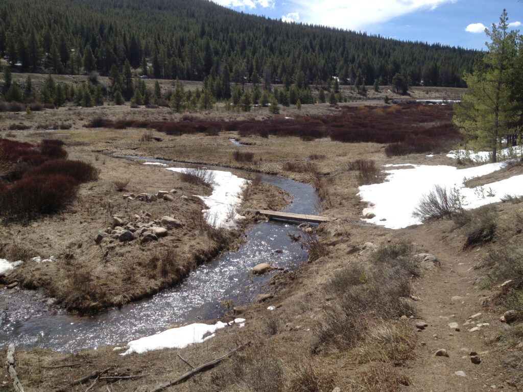
The trail enters an especially scenic stretch, following the willow-filled edge of the spanning valley of Mitchell Creek. Execute multiple creek crossings then reenter the forest and after about another 1.5 miles from the highway crossing cut sharp left onto an old railroad grade. The wide route crosses the remains of log-built bridges and after about another 1.5 miles opens up into some meadows and the ruins of coke ovens. The stone structures heated coal to produce coke, a carbon-rich fuel that was used for steel production. Beyond the ovens it’s only about another quarter mile to the parking area at Tennessee Pass where the shuttle vehicle awaits.

Joe LaFleur has lived in Woodland Park since 2016 and has logged about 200 miles of the Colorado Trail from Denver to the Salida area. Contact Joe with questions or feedback at joelafleur@peakinter.net. Hiking is great exercise but can be hazardous. Always be sure to plan well, check the weather, bring a printed map, tell someone where and when you are going and contact them when you return safely.