


Weather blog: Freezing temps delay gas repairs, intersection west of downtown closed
Parker Seibold, the gazette
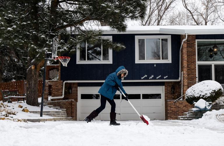
A arctic blast is sweeping through much of the U.S. and the Pikes Peak region this weekend, bringing snow, slick roads and bitterly cold temps that will linger through the beginning of next week.
A winter weather advisory expires at 5 p.m. Saturday.
The next possibility of snow will come Sunday night into Monday morning.
How cold will it get?
Expect highs in the teens this weekend, with subzero lows of -3 degrees on Saturday and -4 degrees on Sunday. Monday will bring single-digit highs, with temperatures potentially dropping to -10 degrees.
An extreme cold watch will be in effect Monday night through Tuesday. The National Weather Service in Pueblo reports dangerously cold wind chills as low as -27 will be possible for the area. Forecasters warn those windchills could cause frostbite on exposed skin in as little as 30 minutes.
See the latest updates below:
Saturday
4 p.m.
The temperature is starting to drop as the sun slowly inches over the mountains. Snowfall has dissipated for now, but a light round of snow Sunday night into Monday is in the forecast. The flurries shouldn’t last past the morning.
Flight delays continue to go up, DIA reported nearly 450 by 4 p.m. The much smaller Colorado Springs Airport only saw 12 delays.
The high in Colorado Springs reached 19 degrees very early in the day at 12:30 a.m. and NWS estimates the low tonight will hit -3. The roads are expected to remain slick as temperatures drop overnight into the morning.
Typically, this time of year is warmer, with the average temperature sitting between a high of 45 degrees and a low of 19 degrees. The record low for Jan. 18 was -20 in 1984.
1 p.m.
Snow showers were expected to peter out by Saturday evening, though snow plow crews are still on full call out and moving to clear secondary roadways.
While primary roadways are passable, some streets are still covered in snow, making it hard for drivers to see the lane markings. City operations reports that the roads are currently icy and snow packed due to cold overnight temperatures and will likely remain icy through this evening, even with “minimal precipitation buildup.”
The West Bijou Street and North Spruce Street intersection near downtown will remain closed for an additional 24 hours due to freezing temperatures.
Colorado Springs Utilities crews were tackling a natural gas leak on Thursday with repairs estimated to take 36 hours. As temperatures dropped, the concrete was not able to cure properly, making unsafe to drive on.
12 p.m.
The second day of the Colorado Springs Metro Wrestling Championships, hosted at Fountain-Fort Carson High School, was canceled due to weather and road conditions in the area.
The Ute Pass and Calhan libraries will be closed today due to icy road conditions.
The latest reported snowfall amounts provided by the National Weather Service show 5.5 inches of accumulation in southern Colorado Springs, 4 inches in southwest Colorado Springs, 2.6 inches in northwest Colorado Springs, and 2.8 inches at Peterson Space Force Base.
When the temperature drops, so do the chances of your car running smoothly. Winter weather can cause issues ranging from dead batteries to frozen fuel lines, but a little preparation can go a long way.Follow us on Social Media!FB:https://www.facebook.com/KOAA/IG:https://www.instagram.com/koaa_5X:https://twitter.com/KOAAGet our App:https://www.koaa.com/apps
11:00 a.m.
Mountain Metro Transit announced routes 2, 12, 15, 19, 39, 20, 32 and 34 will start operations immediately. Officials say they hope to have route 35 and 37 up and running by noon. Routes 8, 16, 18, 23 and 24 remain closed.
Salvation Army told the Gazette they only have five rooms available for families at 11 a.m. In order to get a room they family must have at least one kid who is under 18.
According to Springs Rescue Mission’s website, those seeking shelter can check in at the welcome center 24 hours a day.
9:00 a.m.
Plows are starting to hit secondary roads as primary roads were reported to be passable as of 9:45 a.m. If more snow falls and covers up the plows’ progress then focus will return strictly to primary streets.
Flight delays are on the rise as the day progress, with Denver International Airport reporting 66 delays and Colorado Springs Airport reporting four as of 9:50 a.m. No cancellations have been reported at either airport.
Many counties across the state have opened up warming centers and shelters ahead of the subzero temperatures. Click here for a full list organized by county.
8:00 a.m.
As of 8:30 a.m., the Colorado Springs Airport has seen only two delays. Denver International Airport has seen 48 delays, but no cancellations.
No crashes have shut down major interstates and highways yet, according to CDOT’s online map. Officials warn of icy, snowy and wet roads throughout the region as snow melts and refreezes.
Temperatures are still in the teens, but wind is pushing the real feel temperature into the negatives.
City plows remain focused on primary roads. Side streets may be icy and the city urges the community to exercise caution if they leave their homes today.
7:00 a.m.
Flurries will continue this morning, ending by mid-afternoon. Estimated snow totals in the Pikes Peak Region suggest 3-5″ of snow has fallen so far, according to KOAA meteorologist Casey Dorn. While the bulk of the snow has already fallen, light snow will continue throughout the day on and off adding to the total.
The city announced a full call out as of midnight with 50 plows on the roads this morning. City snow manager Shaun Lucero said the snow keeps building on itself and plows will be mainly focused on primary roads.
The city decided to opt out of using de-icer fluids on the roads due to the incoming sub zero temperatures the region is expected to get over the weekend. The risk of the fluids refreezing and causing slick roads is high and the city is currently spot treating areas with sand to give vehicles better traction.
Some but not all Mountain Metro Transit routes are in service and started on time this morning. The only routes operating this morning are 1, 3, 4, 5, 7, 9, 10, 11, 14, 22, 25, 27, 33 (Ruxton detour in place) and THE ZEB downtown shuttle. Riders should expect delays.
Metro Mobility riders need to call in advance to make sure their trip can be operated today.
At the Colorado Springs Airport, there are no delays or cancellations yet.
Wind chills will be in the negatives from 7 a.m. onward with gusts up to 10-25 mph. A Cold Weather Advisory will begin at 11 p.m. tonight for northern El Paso County and extend through 5 p.m. Monday for wind chills as low as -24.
Friday
8:00 p.m.
Colorado Springs police announced they were on Cold Reporting shortly before 8 p.m. due to snowy road conditions. Accidents not involving alcohol or injuries can be reported here.
Around 7:15 p.m., a crash at Pikes Peak Avenue & Academy Boulevard briefly shut down lanes of traffic, and Colorado Springs police reported that roads were getting slick — with more snow on the way.
According to flightaware.com, nearly 400 flights were delayed at Denver International Airport Friday; three were canceled. At the Colorado Springs Airport, 16 flights were delayed.