


Where are Colorado’s wolves? Map released depicting wolf movement around state
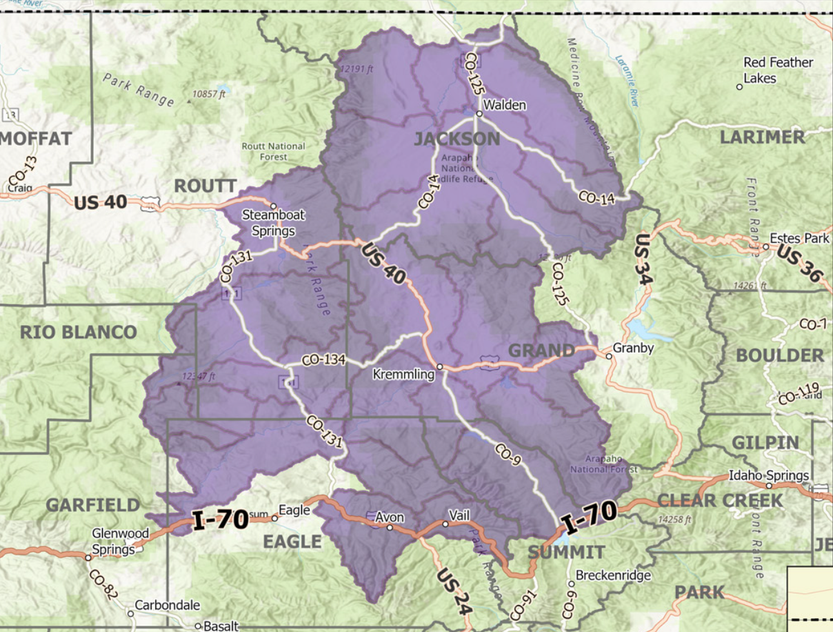
Colorado Parks and Wildlife has released a map that captures the general area that wolves are known to be living in Colorado, helping to inform the public on where they might encounter the species. The mapping tool will be updated on a regular basis.
The range of the wolves currently includes larger portions of Jackson, Grand, Summit, Routt and Eagle counties, as well as smaller portions of Garfield and Rio Blanco counties.
The map was created by using data collected from GPS collars that have been placed on 12 wolves in Colorado, including the 10 that were systematically introduced to the state plus two wolves that naturally migrated into the state, residing in the North Park area.
A ‘wolf activity’ map depicting where collared wolves were active between December 18 and January 22. Map: National Weather Service.
Plans for the map include updating it on the fourth Wednesday of each month, reflecting data collected from the prior month. Authorities are able to see where wolves have been, but not in real time. They are also unable to predict where wolves will go.
It’s also worth noting that this map is based on watershed regions, with indicators that a wolf is present in a watershed area not meaning that wolves are present in the entire watershed region.
The most recent wolf activity map can be found here.
A bill in the Legislature would grant Colorado collaborative authority over its efforts to reintroduce gray wolves.