






Scenic drive along South Platte canyon leads to enjoyable hike | Take a Hike
The CT Series is a special series of hiking articles about the Colorado Trail that will run from May through October. The CT is a unique and well-maintained continuous trail, spanning 485 miles from Denver to Durango. The Colorado Mountain Club Guidebook to the Colorado Trail is an indispensable tool for planning and executing trail excursions. The book divides the CT into 28 segments of varying length. The Colorado Trail Foundation website (coloradotrail.org) also has a ton of useful information.
The drive to the CT South Platte River Trailhead north of Deckers is half the fun. Just before Deckers cottonwoods line the highway, providing a corridor of yellow fall color. Beyond Deckers as the roadway narrows and reduces to dirt, the scenery expands and grows, with the meadow-lined river giving way to stunning rocky cliffs and house-sized boulders parked in the river.
From Woodland Park, drive north on Colorado 67 for about 23 miles to Deckers. Bear right to continue on Colorado 67 that winds along the river. After about 5 miles Colorado 67 cuts sharp right toward Sedalia, but stay straight to follow County Road 97. Continue winding along the river for about 8.5 miles to the trailhead parking on the left, where a large metal trail bridge crosses the river.
Cross the bridge and stay alert for some tricky trail navigation. Just after the bridge turn right and loop around and back under the bridge, heading south along the river, kind of like taking a circular highway off ramp. Begin climbing away from the river, switchbacking and angling along the ridge contour south and west. After about a mile top out on the ridge and be sure to swing right along the main wider route, avoiding the social trail that breaks to the left.
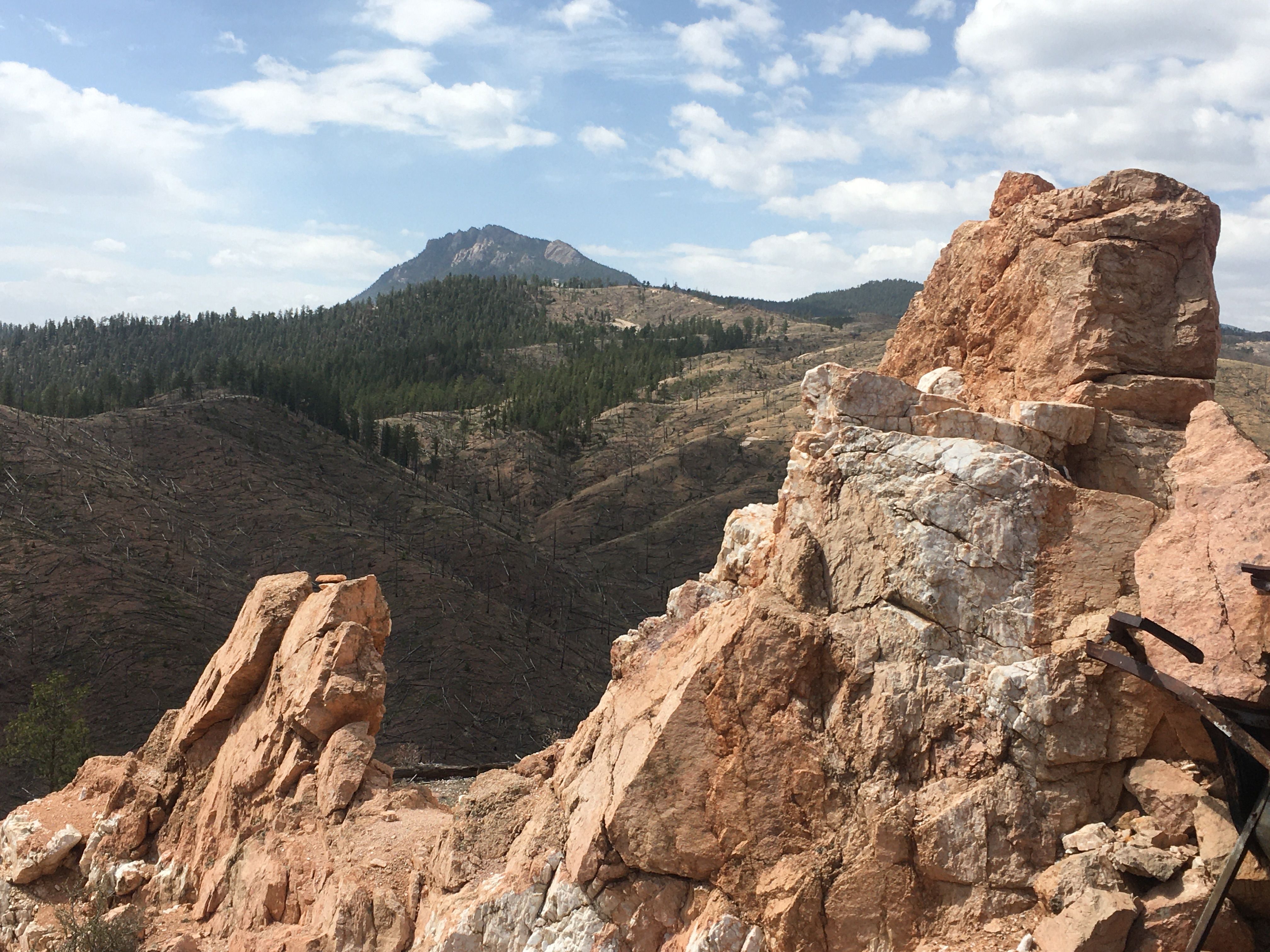
Hiking westward an obvious landmark soon appears on the left, a large orange rock outcrop of Pikes Peak granite at an old quartz mine. Long Scraggy Peak makes a nice backdrop off to the south. Leaving the trees, the trail enters a barren landscape created by the intense Buffalo Creek fire of 1996. The granite of this area decomposes into coarse soil that holds little moisture, which made the forest here even more prone to wildfire. However, the open landscape does reveal impressive rock formations, results of the eroding granite.
Traverse this moon-like landscape for about 2 miles, a section that gets quite hot in the summer. The sun exposure does provide for profusions of wildflowers. During spring and summer sand lily is especially plentiful as well as flowering pincushion barrel cactus. Some scattered shrubs like mountain mahogany and wax currant have colonized the terrain. A couple of aspen groves are returning to the burn area, providing a splash of fall color. During warmer months, a bonus is cute little fence lizards scurrying around the desert environment.
Raleigh Peak serves as a beacon ahead and after about 1.5 miles the trail passes a very large granite outcrop off to the left. The trail begins swinging to the right of Raleigh Peak and after about another half mile reenters the conifer forest, providing some welcome shade. After about another 2 miles of gradual climbing up a ridge, top out among a collection of large boulders where the trail turns sharply left heading south. The blocky Chair Rocks formation stands off to the west, and this vantage point also provides impressive views in multiple directions. Enjoy a break at this scenic spot before retracing the route back to the trailhead.
PARK/NATIONAL FOREST: Pike National Forest
BEST TIMES TO VISIT: April through November
TRAIL INFO: Segment 2, MM 0.0 to MM 5.2 (MM = Mile Marker)
LENGTH: About 10.5 miles out and back hike and about 2,000 feet elevation gain
DIFFICULTY: Easy terrain, moderate on distance
NOTES: The scenic South Platte River Canyon in this area gets a fair amount of weekend vehicle and bike traffic from Denver. For the last few miles before the trailhead, the road is quite narrow so beware of oncoming traffic.
Joe LaFleur has lived in Woodland Park since 2016 and has logged about 200 miles of the Colorado Trail from Denver to the Salida area. Contact Joe with questions or feedback at joelafleur@peakinter.net. Hiking is great exercise but can be hazardous. Always be sure to plan well, check the weather, bring a printed map, tell someone where and when you are going and contact them when you return safely.
The scenic South Platte River Canyon.
A cactus in bloom in the scenic South Platte River Canyon.
South Platte River Canyon is home to a variety of creatures.
A view of the scenic South Platte River Canyon.
JOE LAFLEUR