By
The GazetteApril 13, 2018 | updated 8 years ago
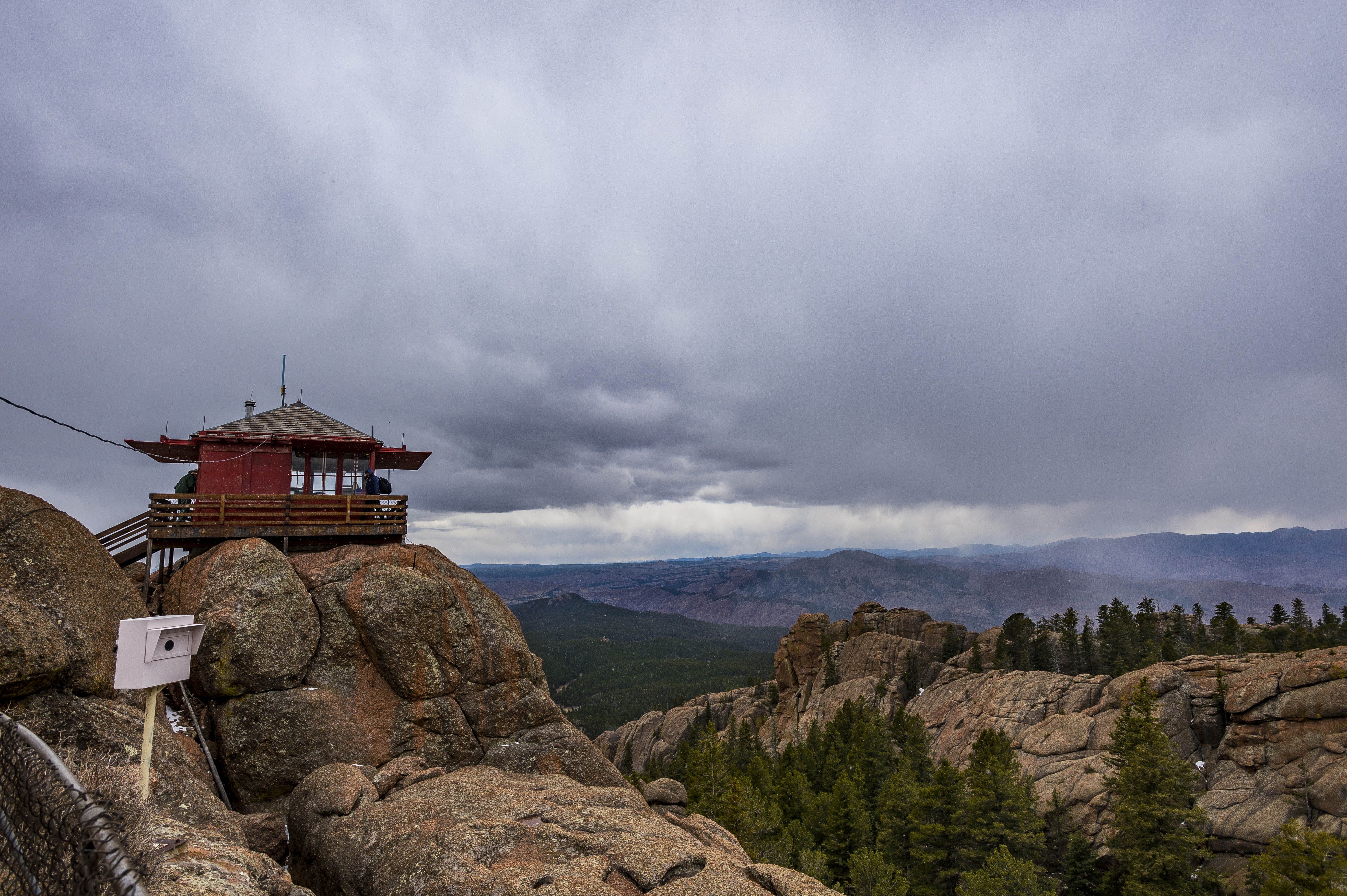
8. Stand watch from Devil's Head Lookout Open seasonally, Devil's Head Lookout is a unique hike that's totally free to access. It's not too long, but it ends with a staircase to the top of an old lookout tower that's still used to spot fires across the Front Range today. (DOUGAL BROWNLIE)
By: Seth Boster, and from The Gazette’s Happy Trails series that highlights trails in the Pikes Peak region and the rest of Colorado.
8. Stand watch from Devil’s Head Lookout Open seasonally, Devil’s Head Lookout is a unique hike that’s totally free to access. It’s not too long, but it ends with a staircase to the top of an old lookout tower that’s still used to spot fires across the Front Range today. (DOUGAL BROWNLIE)Castle Trail, Mount Falcon Park Trip log: 6.14 miles round trip (out and back), 1,535-foot elevation gain, 7,664 feet max Difficulty: Easy-moderate Getting there: Going north on Interstate 25, exit for Colorado 470 west. Continue for about 21 miles before exiting for U.S. 285 south. Soon exit for Colorado 8 toward Morrison. Turn left on Forest Avenue, then right on Vine Street to the park. FYI: If lot is full, find spot on Vine Street. Multi-use, nonmotorized trails. Dogs on leash. Don’t cut switchbacks. Learn more hereSpruce Mountain loop Trip log: 5.6 miles round trip (“lollipop” loop), 657-foot elevation gain, 7,631 feet max Difficulty: Easy Getting there: Going north on I-25, exit for County Line Road. Go left over the bridge and drive 2.6 miles, turning right onto Spruce Mountain Road after the railroad tracks. The open space parking lot will be on the left in 3.5 miles. FYI: Multi-use, nonmotorized trail. Dogs on leash. Lear more here.Iron Mountain, Manitou Springs Trip log: 2 miles round trip (out and back), 938-foot elevation gain, 7,136 feet max Difficulty: Easy Getting there: For the Intemann trailhead off Ruxton Avenue, follow the street to the left of the traffic circle in downtown Manitou. Cross the bridge for Spring Street and follow the dirt path up. FYI: Park at the free lot at Hiawatha Gardens, 10 Old Man’s Trail. Hiking and mountain biking. Dogs on leash. Learn more here.Raccoon Trail, Golden Gate Canyon State Park Trip log: 3.7 miles round trip (“lollipop” loop), 491-foot elevation gain, 9,372 feet max Difficulty: Easy Getting there: From Golden, drive 13 miles on Golden Gate Canyon Road. From the park’s visitor center, follow Colorado 46 west to Colorado 119 north. Off the highway, turn right onto Gap Road and continue to Reverend’s Ridge Campground. FYI: $7 day pass per vehicle. Multi-use trail. Dogs on leash. Could be icy in winter; use traction Learn more here.Lake of Glass, Rocky Mountain National Park Trip log: 8.2 miles round trip (out and back), 1,822-foot elevation gain, 10,808 feet max Difficulty: Difficult Getting there: From the Beaver Meadows entrance on U.S. 36, head west before turning on Bear Lake Road toward Moraine Park. The Glacier Gorge trailhead is about 9 miles away, and the Bear Lake trailhead is farther. FYI: $20 day pass per vehicle. Check road conditions: bit.ly/1rpGrTR. If both lots fill during peak season, take the shuttle near the Bierstadt trailhead. No dogs Learn more here.Homestead loop, Mueller State Park Trip log: 2.8 miles round trip (loop), 497-foot elevation gain, 9,718 feet max Difficulty: Easy Getting there: Off U.S. 24, go south on Colorado 67 to the park. Continue straight on the entrance road, past the visitor center, and park at the Homestead trailhead. FYI: $7 day pass per vehicle. Multi-use trails. No dogs. Learn more here.Paint Mines Interpretive Park Trip log: 2.2 miles, 329-foot elevation gain, 6,672 feet max Difficulty: Easy Getting there: Go east on U.S. 24 through Calhan, turning right on Yoder Street/Calhan Highway, then left on Paint Mines Road to the parking lot. FYI: Park hours dawn to dusk. No fee. No dogs, horses, bikes or off-road vehicles. To avoid damaging the formations, do not climb. (Michael Ciaglo, The Gazette)Quandary Peak, east ridge route Trip log: 6.7 miles round trip (out and back), 3,450-foot elevation gain, 14,265 feet max Difficulty: Extreme Getting there: Off U.S. 24 west, turn north on Colorado 9 and follow through Alma, down Hoosier Pass before turning left on Blue Lakes Road, then right on McCullough Gulch Road to the trailhead. If the parking lot is full, find a spot nearby along the road or in the overflow lot off Blue Lakes Road. FYI: The basic rules of fourteener climbing apply: boots, proper clothing, water and food supply. Avoid in winter due to avalanche risks. Go to 14ers.com for more information and recent trip reports. Learn more here.Mays Peak Trip log: 3.3 miles round trip (out and back), 760-foot elevation gain, 8,284 feet max Difficulty: Easy-Moderate Getting there: From North Cheyenne Cañon’s main entrance, drive to the “hub” parking lot above Helen Hunt Falls. High Drive is at the left side of the ‘Y’ where Lower Gold Camp Road dips to the right. FYI: Multi-use, nonmotorized trail. Dogs on leash. Lear more here.Seven Bridges Trip log: 4.5 miles round trip (out and back), 1,179-foot total elevation gain, 8,708 feet max Difficulty: Moderate Getting there: Off Interstate 25, exit for Tejon Street going south. Take a slight right onto Cheyenne Boulevard and keep right on Cheyenne Canyon Road to the park entrance. Drive up the road about 3 miles, taking the switchback above Helen Hunt Falls to the gravel parking lot. FYI: Hiking and mountain biking. Dogs on leash. Trail could be icy in winter; use traction. Learn more here. (CHRISTIAN MURDOCK, THE GAZETTE)Templeton Trail, Palmer Park Trip log: 4.25 miles round trip (loop), 335-foot total elevation gain, 6,575 feet max Difficulty: Easy to moderate Getting there: Follow through the park entrance on Maizeland Road to the ‘Y’ for Lazy Land. Hang left of the ‘Y’, ending at the Yucca Flats parking lot. FYI: Multi-use trail. Dogs on leash. Trail could be icy in winter; use traction. Learn more here. (The Gazette)Heizer Trail Trip log: 6.76 miles round trip (out and back from “T”), 1,949-foot total elevation gain, 8,790 feet max Difficulty: Moderate to difficult Getting there: Off U.S. 24 west, turn left at the light for Pikes Peak Highway and quickly left onto Emporia Avenue, following into Cascade. Park on the side of the road by the park and see the sign for the trail up Park Street. FYI: Hiking and biking. Dogs on leash. Trail could be icy in winter; use traction. Learn more here.Goose Creek Trail to Shaft House, Lost Creek Wilderness Trip log: 8 miles round trip (out and back), 1,100-foot total elevation gain, 9,500 feet max Difficulty: Moderate Getting there: Going west on U.S. 24, continue through Florissant and Lake George. Turn right onto County Road 77. After about 7 miles, turn right onto Matukat Road, which becomes Forest Road 211. Follow 11½ miles to the trail’s parking lot. FYI: High-clearance vehicle/four-wheel drive recommended but not required. Hiking and horse riding only in wilderness areas. Dogs on leash. Trails could be icy in winter. Learn more here.Garden of the Gods trail Trip log: 3.85 miles round trip (loop), 367-foot total elevation gain, 6,555 feet max Difficulty: Easy Getting there: The main parking lot is reached by taking the road into the park off 30th Street, where the visitors center is. FYI: See trail maps for sections where bikes and horses are allowed. Dogs on leash, except in designated unleashed area. Trails could be icy in winter. Learn more here.Pikes Peak shows itself from a viewpoint along the Buckhorn loop trail in North Cheyenne Canon Park. Credit: Seth BosterEarly into the hike to Lost Lake in the Indian Peaks Wilderness, come to a pond with a scenic mountain backdrop. Photo credit: Seth Boster(The Gazette)Red Rock Canyon sits along Highway 24 between 26 Street and 31st Street. More than 700 acres have been in private hands since early in the 20th century. Now Zydeco, a real estate developer from Santa Fe has a contract to purchase the property and build an 18 hold golf course, a hotel, and multi family and single family housing on the site. Photo/kelley (Kelley)The Royal Arch sits at 6,920 feet in the forest above Chautauqua Park. Credit: Seth BosterBlodgett Peak looms over the trail from Blodgett Peak Open Space. Colorado Springs parks warns of a “difficult and treacherous” climb.Sara Scherschligt, 22, a student of the University of Kansas takes a swim in Willow Lake after a day helping the local nonprofit Rocky Mountain Field Institute with trail building on Saturday July 29, 2017. The organization invites college-aged students from around the country to a 30-day program that starts in the classroom and ends in the field. The students work on the realignment of the Kit Carson-Challenger Ridge Summit Trail in the Sangre de Cristo Mountain Range. (Photo by Dougal Brownlie, The Gazette). (DOUGAL BROWNLIE)Cheyenne Mountain State Park will offer three free guided hikes on New Year’s Day. Visitors will still need to purchase a $7 parks pass for the day. Photo credit: The GazetteA hikers climb the Manitou Springs Incline Tuesday, May 24, 2016. (The Gazette, Christian Murdock) (The Gazette)The view at the end of the Pancake Rocks trail in Teller County. Photo credit: Seth Boster (Seth Boster)The Challenge Hill, Castle Rock Trip log: 0.10 miles up the hill, 0.4-mile trail down, 168-foot elevation gain, 6,509 feet max Difficulty: Difficult Getting there: Off Interstate 25, exit for Plum Creek Parkway and turn left. The park is on the left side of the road. FYI: No dogs on Challenge Hill.