25 most popular hiking and biking trails in Colorado Springs and Pikes Peak region
By
The GazetteMarch 22, 2018 | updated 8 years ago
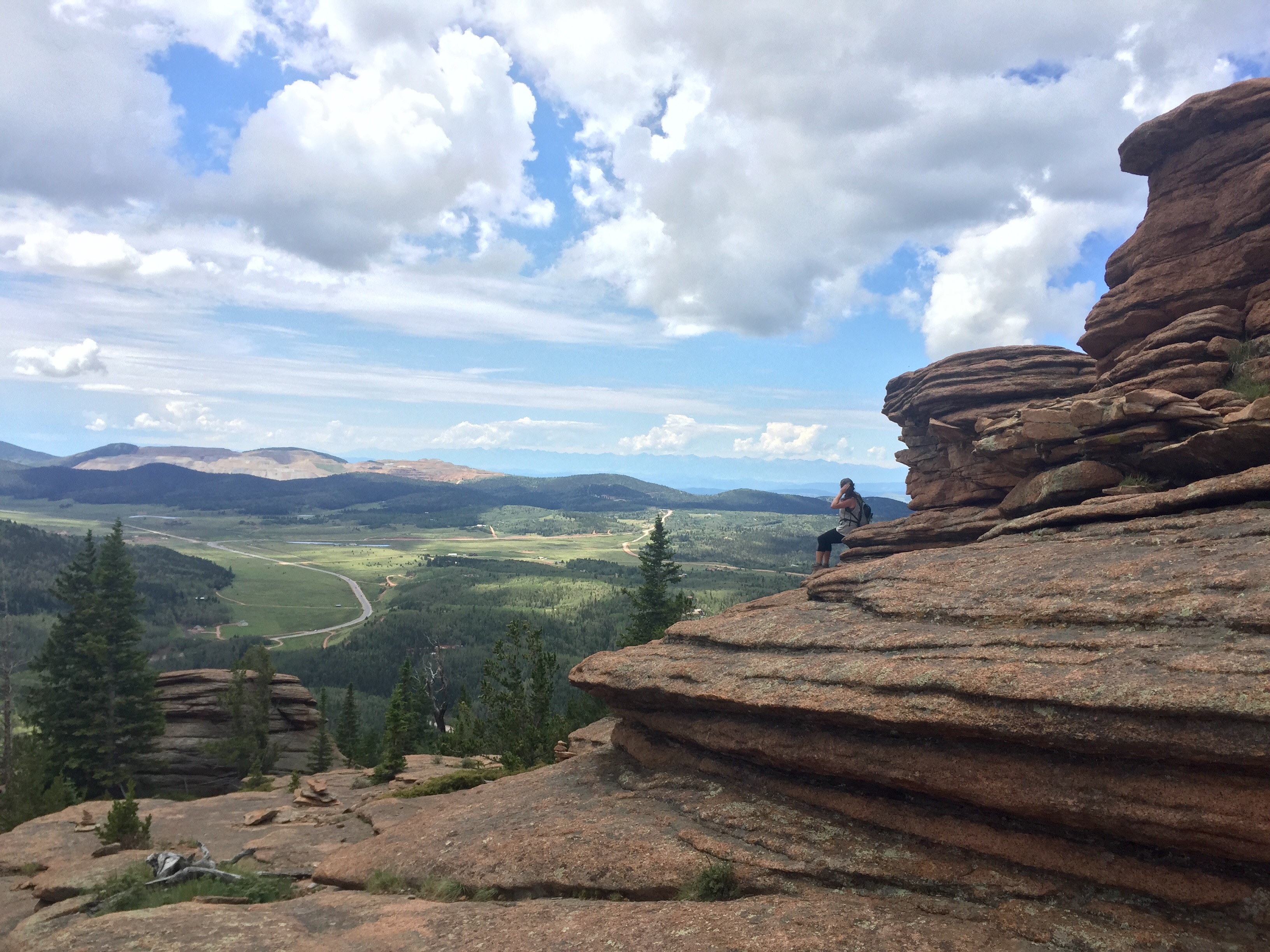
The view at the end of the Pancake Rocks trail in Teller County. Photo credit: Seth Boster (Seth Boster)
The Pikes Peak region is a hiking and biking mecca, as so many already know.Here’s a look at the top 25 hiking and biking trails, according to visitcos.com
The view at the end of the Pancake Rocks trail in Teller County. Photo credit: Seth Boster (Seth Boster)(The Gazette)#12. South Slope Recreation Area Difficulty: Easy to Moderate This area recently opened to the public after being off limits for more than 100 years. Access is by permit only on the ColoradoSprings.gov website. The 4.7-mile trail (one-way) takes you past three reservoirs, through meadows and offers a unique view of the south side of Pikes Peak. Learn more here. (The Gazette)#8. Lovell Gulch Trail Difficulty: Moderate This loop trail takes you on a pleasant 5-mile hike near Woodland Park. Once at the ridge you’ll have a great view of the north face of Pikes Peak. Learn more here. (Seth Boster, The Gazette)#11. Mueller State Park Difficulty: Easy to Moderate Scenic wildlife viewing of elk, bighorn sheep and birds on 5,511 acres of land with 55 miles of hiking & biking trails. No dogs. Entrance fee. Learn more here. (The Gazette)#10. Mt. Cutler Difficulty: Easy This one-way trail parallels N. Cheyenne Canon Road and heads up to the summit. Along the way, you’ll see great views of Stratton Open Space, Seven Falls and Will Rogers Shrine. Learn more here. (The Gazette)#6. Mt. Hermann trail Difficulty: Moderate A 4-mile out-and-back trail rated as moderate with great views of Monument, Colorado Springs and the mountains. Learn more here. (The Gazette)Paint Mines Interpretive Park Trip log: 2.2 miles, 329-foot elevation gain, 6,672 feet max Difficulty: Easy Getting there: Go east on U.S. 24 through Calhan, turning right on Yoder Street/Calhan Highway, then left on Paint Mines Road to the parking lot. FYI: Park hours dawn to dusk. No fee. No dogs, horses, bikes or off-road vehicles. To avoid damaging the formations, do not climb. (Michael Ciaglo, The Gazette)Hikers along Catamount Trail near Green Mountain Falls. (The Gazette file)Celebrate Waterfall Wednesday At OutThere Colorado, we can’t get enough of “Waterfall Wednesday.” The challenge is simple, dedicate a random Wednesday this spring to finding one of those Colorado waterfalls you’ve been drooling over for years. (The Gazette)The mountains are pictured along the Buckhorn loop trail in North Cheyenne Canon Park. (Seth Boster, The Gazette)Hikers cross the new third bridge over North Cheyenne Creek Wednesday, Oct. 26, 2016, while hiking the Seven Bridges Trail outside Colorado Springs. The third and seventh bridges were recently replaced on the popular North Cheyenne Canyon trail. (The Gazette, Christian Murdock) (Christian Murdock, The Gazette)#11. Intemann Trail Difficulty: Moderate This new 3-mile trail (round-trip) is part of the Intemann Trail and provides access to a summit that was only recently open to the public. Learn more here. (The Gazette)Incline enthusiasts race up the trail after the ribbon cutting and re-opening on Friday, December 2, 2016. The Manitou Incline re-opened to the public after being closed for repairs for roughly three months. Improved safety, enhanced user experience, long-term sustainability and increased accessibility were the four major goals of the Incline project. Work included repair and replacement of damaged retaining walls, cleanup of rebar, construction of drainage structures, stabilization of existing ties and surrounding slopes. Photo by Stacie Scott, The Gazette (The Gazette)#7. Palmer Loop Trail Difficulty: Moderate (Also known as Red Rock Palmer Loop Trail) A 6-mile loop hike of moderate difficulty among the pine forest with spectacular views, shade and a small waterfall. Learn more here. (The Gazette)#8. Midland Trail Difficulty: Easy This 5-mile trail runs from the town of Manitou Springs to American the Beautiful Park in Colorado Springs; some parts of the trail are on streets. Learn more here. (Christian Murdock, The Gazette)#9. Barr Trail Difficulty: Moderate to Difficult 12-mile (one-way) hike gaining 7,800 vertical feet from Manitou Springs to the 14,115-foot summit of Pikes Peak – America’s Mountain. Hike down or take the Broadmoor’s Manitou and Pikes Peak Cog Railway. Learn more here. (Dougal Brownlie, The Gazette)#7. Fountain Creek Park Difficulty: Easy View wildlife, marshes, streams and ponds as you hike these gentle and shaded trails. Learn more here. (Jerilee Bennett, The Gazette)#6. Bear Creek Dog Park Difficulty: Easy Located near the foothills, this 25-acre off-leash park provides dogs and their owners with a variety of hiking options; great amenities such as shade, creek, small-dog area, agility course and restrooms. Named a top-10 US dog park and considered to be among the region’s finest. Learn more here. (The Gazette)#5. Austin Bluffs Open Space Difficulty: Easy to Moderate This area is known for unique rock formations created by the most recent geological uplift. The 585 acres can be accessed via two trailheads. Learn more here. (The Gazette)Templeton Trail, Palmer Park Trip log: 4.25 miles round trip (loop), 335-foot total elevation gain, 6,575 feet max Difficulty: Easy to moderate Getting there: Follow through the park entrance on Maizeland Road to the ‘Y’ for Lazy Land. Hang left of the ‘Y’, ending at the Yucca Flats parking lot. FYI: Multi-use trail. Dogs on leash. Trail could be icy in winter; use traction. Learn more here. (The Gazette)#3. Cheyenne Mountain State Park Difficulty: Easy to Moderate Just south of Colorado Springs you can explore nature’s diversity on 2,700 acres with prairie-to-peak ecosystems on 20 miles of hiking and biking trails. Dogs are welcome. Entrance fee. Learn more here. (The Gazette)(Reader-submitted photo by C.J. Kyles)#2. Red Rock Canyon Open Space Difficulty: Easy to Moderate A variety of trails wind along the canyons and ridges of red rock and provide great views of Garden of the Gods. These trails connect to many other hiking trails in the area. There are two off-leash dog loops and a free-ride bike park. Learn more here. (Christian Murdock, The Gazette)#9. Ute Pass Trail Difficulty: Moderate The Ute Pass Trail runs along the north side of Pikes Peak. It was believed to have first been a buffalo trail until the 1860’s when it became a wagon road. The Ute Indians also used the trail to travel through the Ute Pass. Learn more here. (manitousprings.org)