






Pikes Peak International Hill Climb: How monikers got their names
The Pikes Peak Highway has operated for over 100 years, taking drivers from Cascade, Colorado (elevation: 7,379 feet) to the peak of America’s Mountain (elevation: 14,115 feet). Once dirt and gravel, the road has evolved, as have the vehicles ascending to the peak. On the Pikes Peak International Hill Climb course, 32 distinct monikers differentiate corners, straits, landmarks and sewage dumps along the way.
Crystal Work Road: As drivers begin the course, a path on the left side of the road swings down to the headwaters of Crystal Reservoir. The gravel pit road snakes through trees and is used to check the reservoir’s headwaters.
Hansen’s corner: This section was once privately owned by George Hansen, who chose to close the road to traffic. The issue was taken to court by park officials and was eventually reopened, but the Park had to pay a fee.
8 Mile Road Pit: At the 8-mile marker, an old path leads to a gravel pit used to repair the main highway. The pit is no longer used.
Horseshoe: One of the more obvious names, Horseshoe was given its moniker because of a horseshoe-shaped parking area located to the left of the road.
Engineers Corner: So many drivers have flown off the road at Engineers Corner that it was determined only engineers would be able to navigate around the bend. This corner is one of the most notorious on the track.
Halfway Picnic Grounds: The fastest part of the course, aptly named because it is located approximately halfway between the start line and Glen Cove. In the early days of Pikes Peak, horse tours were offered up the mountain, and this was the point in which guides were instructed to tell tourists they made it halfway.
Gayler’s Straits: Former Pikes Peak highway manager Tom Gayler once drove off the road on this 1,645-foot section of the course. Gayler was driving up the mountain to deliver gas to a man near the top, but fell asleep at the straits. His vehicle rolled three times, but he was not severely injured.
Brown Bush Corner: The first switchback on the course was given its name because of a brown bush that used to be located roadside. It has since been removed, but the corner still retains its name.
Big Spring: A natural spring runs along the road at this point, and runs into a pipe that deposits the water on the other side of the road.
Blue Sky: For many years, the view from this location was only the sky, thus its name. In recent years, trees have grown tall enough to become visible.
11 Mile Water Station: Water faucets used to stand near the 11-mile marker so drivers could cool down their cars’ radiators. The water pipes are gone now, but race-goers have made this spot a popular observation area.
Heitman’s Hill: The hill was given its name because Chuck Heitman rolled his car after getting too close to the road’s edge. Heitman, who served as the assistant to the city manager of Colorado Springs, was uninjured, but had to bail out of his car at the last minute. The Idaho native’s ashes were later spread at the summit of Pikes Peak after he died in 1982.
Grouse Hill: A large flock of grouse used to populate the area around this hill. In the mornings, groups of the birds were visible from the road.
Gilly’s Corner: A patrolman with the last name Gilly rolled his car coming around this corner.
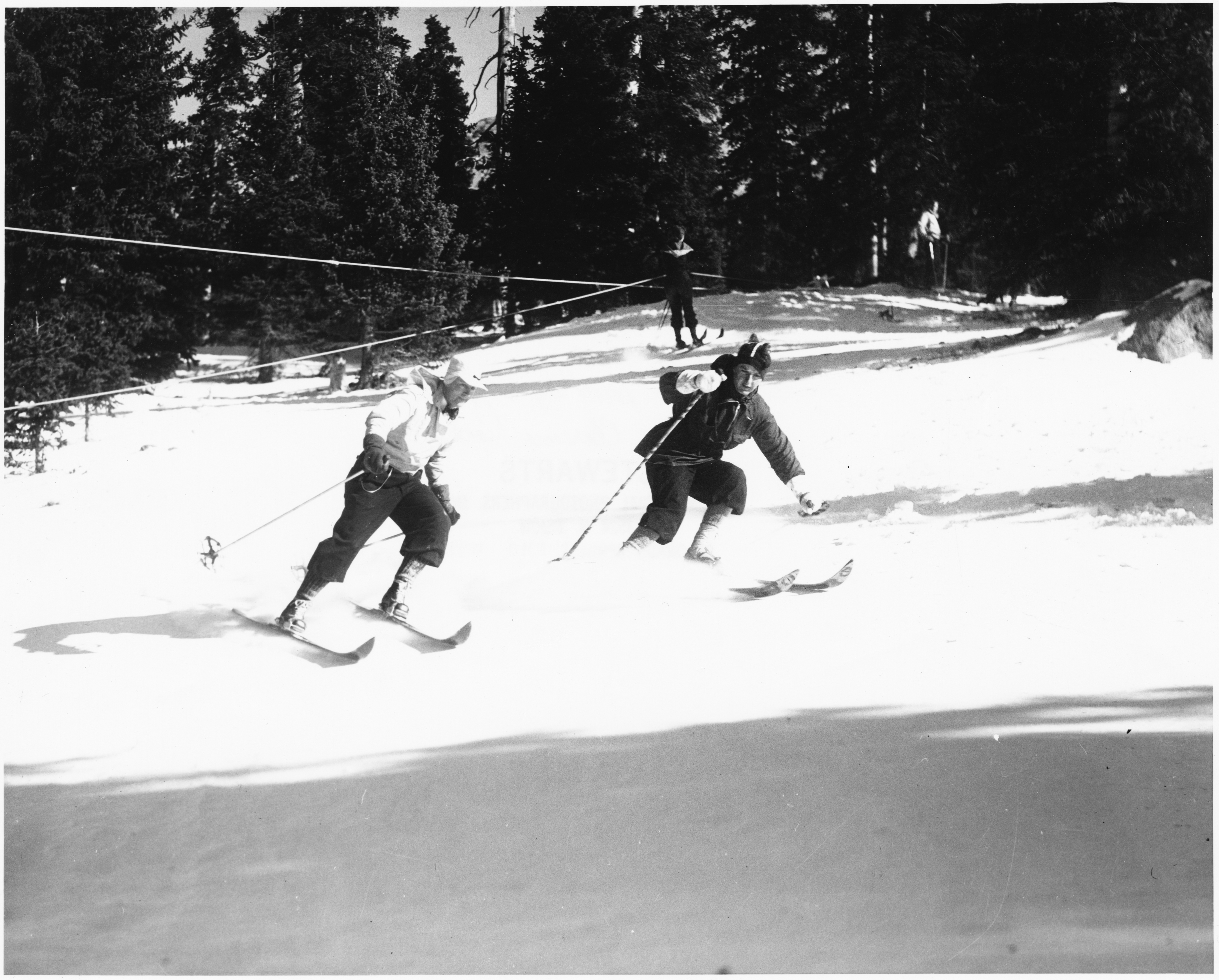
Ski Area: The Pikes Peak Ski Area operated from 1939-1984, and it was the major skiing attraction in Colorado Springs for decades. An expansion effort in the early 1980s proved to be futile, as lack of snow and financial issues led to the resort closing in 1984. Today, the ski area is a popular place to park and watch the race.
Sump: Sewage from the Glen Cove Inn ran down the mountain into a brown pond off the left side of the road. The pond was later blocked off, and now sewage is trucked down the mountain.
Tin Barn: Years ago, a tin barn stood nearly 400 feet north of the main highway, down a gravel road. Both the road and barn were built by the Civilian Conservation Corps, a public work relief program that was created under the New Deal. The barn no longer stands in its original place, but the foundation remains.
Glen Cove: Constructed as a large log cabin, the Glen Cove Inn was a popular place for tourists to relax when they traveled to the peak on horseback. The cabin was originally settled by Frank Tweed in 1886 and he later turned the property into a station for visitors to stop on their way up the mountain. Glen Cove later became a hotel, and today it serves as a small restaurant and souvenir shop.
George’s Corner: Prior to every Pikes Peak Hill Climb, members of the road crew were stationed at this point in order to prevent drivers from cutting the corner and causing washboards. George Pusnick, a member of the crew, claimed the corner as his own and it was then named after him.
Cove Creek: A ditch was built off the side of the highway for runoff water. The runoff comes from Glen Cove Creek, a stream that filters into Crystal Reservoir.
Elk Park: This point was given its name because of a herd of elk that used to be seen alongside the road.
Ragged Edge: Just after turning the corner, a ragged rock sits on the left side of the road. Today, this is a popular spot for bouldering.
Double Cut: Was named Double Cut because drivers used to be able to choose between two roads that were divided by a hill. They generally picked the outside road because it was better for faster speeds. The hill has since been removed, turning Double Cut into one large corner.
Start of 1st Leg: This is the beginning of the W’s on the Pikes Peak Highway. These intense turns form the letter “W” and it’s important for drivers to count the legs so they don’t forget which corner they are on.
Devil’s Playground: Lightning storms are common on this area of the mountain, and this corner is regarded as the most dangerous during such weather. A sign stands on the side of the road, noting origins of the name “because of the way lightning jumps from rock to rock during a thunderstorm.”
Bottomless Pit: One of the road’s more spectacular views, Bottomless Pit was given its name due to the severe drop-off. Tourists can look over a rock wall to the bottom, but its extreme distance makes it seem almost bottomless.
Upper Gravel Pit: Rocks of all shapes and sizes filled this gravel pit used to resurface the road. The pit has since been closed.
Boulder Park: This turn, filled with boulders on both sides of the road, is the switchback before the 19-mile hill.
Cog Cut: The Broadmoor Pikes Peak Cog Railway will celebrate 125 years of operation this summer, and since the highway’s construction, this corner is the closest the train gets to the road.
Olympic: One of the final turns before the finish line, Olympic is arguably the worst place to slide off the road on the entire mountain. A steep cliff drops off the left side of the highway, plummeting 2,000 vertical feet. Years ago, the Summit House on top of the mountain flew the Olympic flag. This corner was the first time drivers could see the flag, indicating they were close to the summit.
Finish Line: After 156 turns, 4,720 feet of elevation and 12.42 miles, drivers reach the finish line.
Summit: At 14,115 feet, Pikes Peak is the most eastern 14,000-foot mountain in the United States. The first American sighting of the mountain was by Zebulon Pike in 1806, and though the mountain now bears his name, he never managed to reach the summit. Edwin James, a young botanist, geographer and geologist, was the first to reach the top in 1820.
Cars of all types race to the top of Pikes Peak during The Boradmoor Pikes Peak International Hill Climb at the summit on Saturday, June 28, 2015. Due to thunderstorms and heavy snow that accumulated at the summit, the race was shorted and moved to The Cove, which is located about halfway up the mountain. Photo by Logan Riely, The Gazette
# 4 Engineer’s Corner: So many drivers have flown off the road at Engineers Corner that it was determined only engineers would be able to navigate around the bend. This corner, just after the 9-mile marker, is one of the most notorious on the entire track.
Don Lawrie, left, and Bob Potter ski at the Glen Cove Ski Area in this undated photograph. Glen Cove boasted the state’s first rope tow in 1936 but quickly fizzled, joining the ranks of abandoned ski areas.
A monster snow machine sits at Glen Cove at 11,500 feet, ready to plow through the deepest of snows along the highway.
Randy Schranz kicks up dirt on day three at the Pikes Peak International Hill Climb near Glen Cove on June 25, 2010.