






Colorado DOT explores mitigation of loose sediment above Highway 24
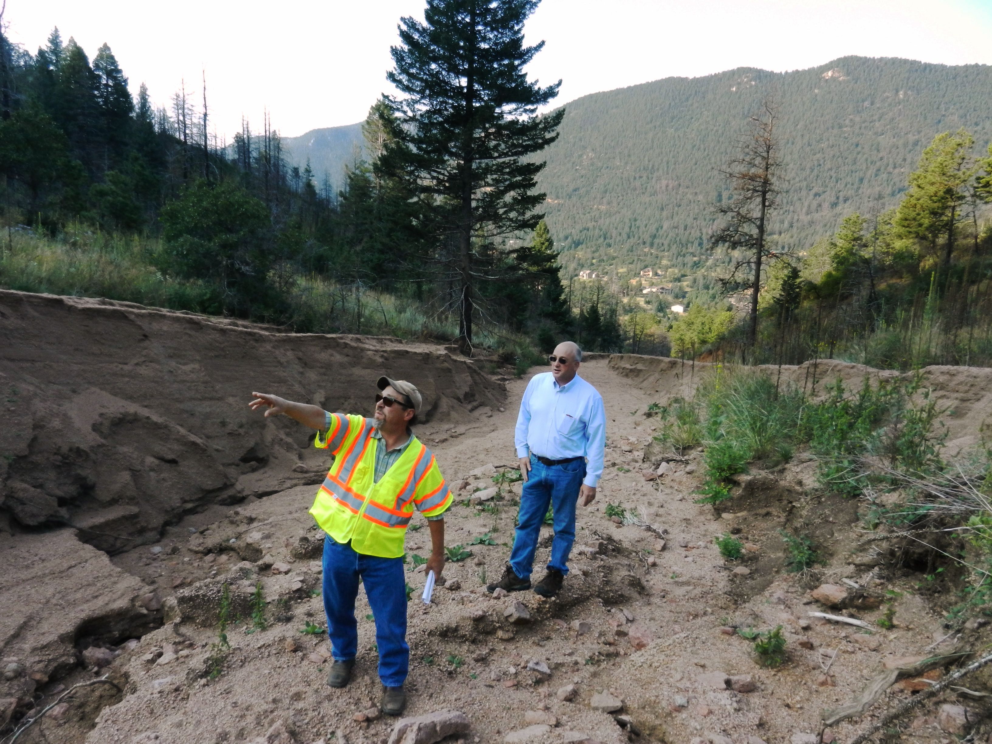
John Chavez stood on a wide swath of sediment high in the mountains above U.S. Highway 24 near Cascade. The engineer with El Paso County Public Services sifted handfuls of loose Pikes Peak granite through his fingers and looked around at the expanse of what he calls “fluff.”
“There’s not much you can do to stabilize this stuff,” Chavez said on Aug. 27 while leading The Gazette on a hike to see firsthand how much of that “fluff” is precariously waiting to come down if an epic storm pounds the Waldo Canyon Fire burn scar.
If such a storm were to hit in just the right spot, the highway below Fern Gulch could potentially be closed, once again choking off the main artery from Colorado Springs to Teller County.
Chavez, Dave Watt of the Colorado Department of Transportation , and others who have led Waldo Canyon Fire recovery over the last three years have all confirmed that there are tens-of-thousands of cubic yards of sediment staged in multiple watersheds along U.S. 24 between Manitou Springs and Woodland Park.
In some places up the mountain, the sediment collected in the Fern Gulch is 60 feet wide and up to about 12 feet deep. That, combined with 20-percent grades in the channel and steep damaged slopes with little vegetation surrounding it make Fern the most worrisome in the corridor when it comes to protecting Highway 24.
Since the June 2012 fire, similar sediment has mixed with heavy rainwaters that have run down from the Waldo Canyon burn area and caused several flash floods from Teller County to Manitou Springs and in parts of western Colorado Springs. Millions of dollars have been spent on cleanup, reconstruction of channels and mitigation work. And agencies like the Federal Emergency Management Association have come to the aid of residents and government officials on several occasions.
Carol Ekarius, with the Coalition for the Upper South Platte, said it’s a “crapshoot with nature” to proactively mitigate in areas where the biggest threats loom. She said the lack of homes near Fern Gulch and CDOT’s construction of a large stone runoff and a sediment retention pond at the base of the gulch have directed most mitigation money to other projects.
Ekarius believes that the right storm in the right place would not only bring Chavez’s “fluff” rampaging down the mountain, it could overwhelm the work CDOT has done and cause long-term closures of the highway.
“If we got a two-inch per hour rainstorm, there’s so much head cutting going on up there that’s moving things around that I personally would hate to see what would happen to 24,” she said. “There’s just no predicting which drainage will get that high intensity rain.”
Chavez said it would be a “huge cost” to proactively clean out the steep channel in Fern Gulch. Ekarius put a number on that cost, saying the price tag has been estimated at about $2.5 million.
“That’s a lot of money for one drainage,” Ekarius said. “And right now, that two-and-a-half million dollars is not in anybody’s pocket.”
CDOT’s work at the base of Fern Gulch came after the Waldo Canyon fire was extinguished. In July 2012, tons of sediment spilled onto U.S. 24, trapped vehicles and damaged homes and businesses on the south side of the roadway.
The closures continued over the next couple of years. In 2013, U.S. 24 between Colorado Springs and Teller County closed 17 times. Work was done by CDOT, CUSP and other agencies, including the construction of the Fern Gulch runoff and basin and a large culvert that was installed under the highway near Manitou Springs.
As a result of that work, the number of closures has gone down each of the last two years. In 2014, CDOT close the highway nine times and is yet to close the U.S. 24 from flowing debris in 2015, Watt said.
The continued decline in closure numbers has raised CDOT’s confidence in their mitigation work. Watt said the closure protocol was changed as a result. In the past, CDOT gauged road safety on rain rates. In 2015, they’ve turned to monitoring sediment flow.
“We’re actually waiting for debris to come down before we close the highway,” Watt said.
In three years, Watt’s crews have removed about 8,000 cubic yards from the retention basin that has a capacity of about 500 cubic yards at the base of Fern Gulch. About 2,000 of that was pulled out in 2015 after spring and early summer rains saturated the region.
Ekarius said there is talk of putting another retention basin just above the work CDOT has already done at the base of Fern Gulch. That pond would be emptied after each storm, she said.
According to Watt, CDOT is exploring other mitigation alternatives as well. He said one possibility would be to install a culvert that could divert debris from Fern Gulch debris under U.S. 24.
“We’ve looked a couple alternatives,” he said. “And we are going to look at that assessment and report it out in the next month.”


