






Weekend storms in Pikes Peak region skip burn scar
Burn scars in El Paso County dodged proverbial bullets Sunday.
Monsoon thunderstorm systems rolled into the Pikes Peak region, prompted a flash flood warning and soaked the area, but they didn’t pack a punch.
“The heaviest of the rain missed the scar. There really was no threat to U.S. 24 at all,” said Brian Bledsoe, chief meteorologist Gazette news partner KKTV. “The flash flood warning was precautional, but it always takes just one storm to make a difference.”
According to the National Weather Service, about 1.6 inches of rain fell over the northern portion of the U.S. Air Force Academy in about 15 minutes by 4 p.m.
At Peterson Air Force Base, .98 inches were measured and 1.22 inches of rain accumulated in Falcon, where quarter-size hail covered roads and parking lots. The flood warning, which included eastern Colorado Springs, Falcon and Schriever Air Force Base, expired at 4:30 p.m.
“The heaviest rain in El Paso County was probably in Falcon, where some areas got up to 3 inches of rain, and creeks were running pretty high,” Bledsoe said.
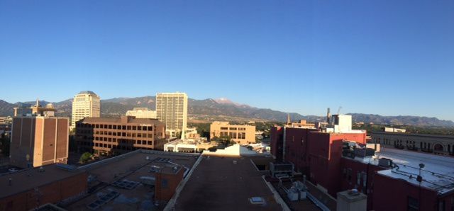
Higher altitudes in El Paso County even got some snow, as the summit of Pikes Peak was freshly covered with about one inch of powder.
The weather service said .6 inches of rain fell over Woodland Park in under an hour, while in Florissant weather observers measured .34 inches.
About 18 miles of Highway 67 between Cripple Creek and Divide were closed for several hours Sunday afternoon when hail blanketed the highway and stranded motorists whose cars got stuck in the slush, according to Colorado Department of Transportation officials.
With the monsoon season still in full swing, Bledsoe said thunderstorms will be a daily occurrence in Colorado, and more rain increases the probability of flash floods on any of the burn scars.
“We’ve gotten plenty of rain in the Pikes Peak region, but the burn scars have gotten really lucky, especially Waldo Canyon,” he said. “At the same time, these afternoon storms happen every day, and each one has the potential for heavy localized rain and flash flooding.”
Slightly drier conditions and sunnier skies along the Front Range are in forecast for Monday and Tuesday. A new round of thunderstorms should roll in about the middle of the week, the weather service said.
Mostly sunny skies with a high near 78 and a 20 percent chance of showers and thunderstorms after 11 a.m. were in the forecast for Monday, according to the weather service.
–
Contact Andrea Sinclair: 636-0235
Twitter: @GazetteAndrea
Facebook: facebook.com/andrea.sinclair.376
The view from downtown Colorado Springs Monday morning of Pikes Peak with a new dusting of snow. (Jerry Herman, The Gazette)