






Recent rains bring only slight relief from drought
Recent monsoonal thunderstorms have soaked the Front Range with more rainfall than usual, but Colorado is not out of the dust bowl.
Because droughts are fixed with snow, not rain.
According to the most recent report from the U.S. Drought Monitor, there has been some improvement in drought conditions across most of south-central and southeast Colorado.
“Currently, more than half of the state is free of drought while 40 percent is experiencing drought ranging from abnormally dry to exceptional,” the monitor’s July 2014 Drought Update said.
“The drought that is impacting southeastern Colorado is now well into its fourth year, but recent rains have brought some relief.”
Across the southeastern plains, the area in extreme drought decreased by 5.58 percent and the area in severe drought dropped by 1.75 percent from July 1 to July 25, the report showed. Only 0.92 percent of southeastern Colorado remained in exceptional drought, down from 1.89 percent at the start of the month.
More rain, snow needed
And while the recent wet weather helps, Brian Bledsoe, chief meteorologist of Gazette news partner KKTV 11 News, said Wednesday that more is needed to alleviate the conditions brought on by four years of drought across southern Colorado.
“The damage that the drought has done over the past four years has been really widespread, and it has affected the soil’s ability to absorb moisture,” Bledsoe said. “I would equate it with pouring a glass of water over a kitchen table.”
Even if daily showers continue into next week, as predicted, National Weather Service meteorologist Eric Petersen said it will take more than one monsoon season to fully revitalize the state.
“For most of the summer a lot of the eastern plains have been a little wetter than normal, and this July several heavy thunderstorms over the plains have helped the drought areas,” Petersen said.
“We all need to be aware that while we’ve had a fairly wet pattern for the past couple of months, the drought takes shape through several years, and it will take much more than a couple of months of rain to take care of it,” he said.
July temperatures were split across the state, with warmer conditions west of the divide and cooler conditions on the Front Range and eastern plains, the report stated.
The lower temperatures, combined with extra precipitation, helped abate drought conditions in the region.
Statewide reservoir storage is strong, with some providers reporting their best yields since 2001. The northern portion of the state is seeing higher storage levels than the southern half, according to the monitor report.
Exceptional drought conditions are now confined to southwestern and west-central Kiowa County, extreme northern Bent County, extreme southeastern Crowley County and extreme northeastern Otero County, the report said.
With the exception of extreme southeastern El Paso County, the rest of the Pikes Peak region was determined to be drought-free.
The monsoon season has already caused plenty of flooding, especially across the southeast plains, where ground saturation could be approaching higher-than-normal levels, Petersen said.
The weather service did not have ground saturation measurements available at the time of this report.
“There was some seriously localized heavy rainfall in some parts of Kiowa County, where they reported up to six inches of accumulation,” Petersen said.
“With the extended forecast calling for more thunderstorms in their region, it won’t take much for flash flooding to occur.”
Northern and southeastern Colorado got the worst of Tuesday’s storms that flooded streets and stranded drivers up and down the Front Range.
A record-breaking 1.8 inches of rain fell at Denver International Airport, and U.S. 50 through La Junta was closed for several hours as police reported up to 6 inches of standing water on the roadway.
No records were broken in El Paso County, but nearly 1.5 inches of rain had fallen over southwest Colorado Springs by Tuesday night and more than .75 inch was reported in the northeast part of the city.
While the region’s burn scars largely were unaffected by recent rains, they and the area’s below them remain vulnerable, experts said.
“It’s still fairly early into the season and looking at the extended forecast, the mountains will still be fairly wet for several weeks,” Peterson said.
“We haven’t had a significant flooding event yet, but that doesn’t mean one isn’t possible this season.”
–
Contact Andrea Sinclair: 636-0235
Twitter @GazetteAndrea
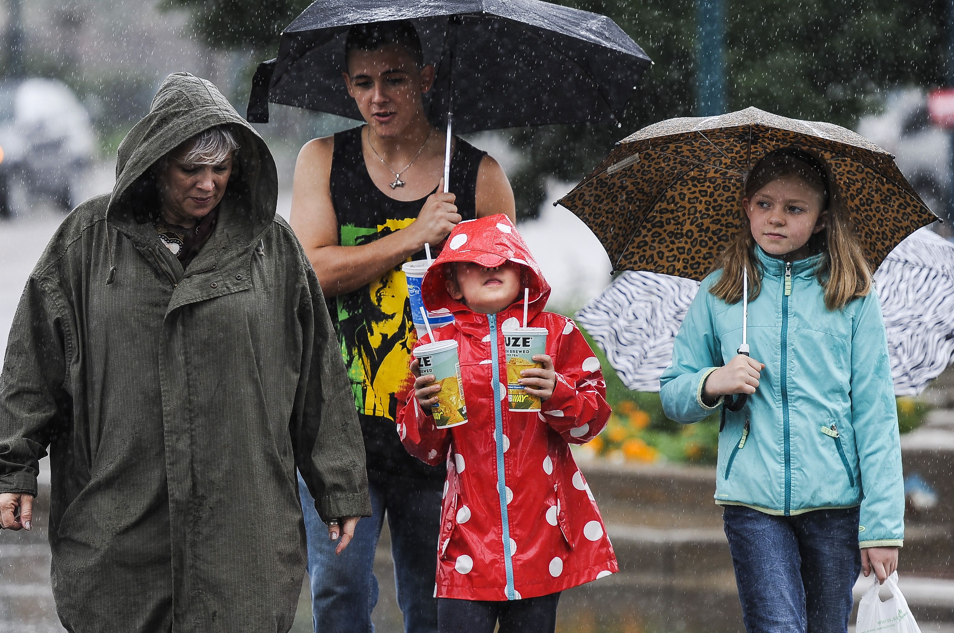
Vivian Modeer, 7, center, tries to look out from under her hood as she walks through downtown with Lillian Modeer, 10, right, Jesse Willett, second from left, and Binky Chandler, left, as monsoon weather moves through the area Wednesday, July 30, 2014. Michael Ciaglo, The Gazette
Lisa Paris crosses Tejon Street carrying a panda umbrella as monsoon weather moves through the area Wednesday, July 30, 2014. Michael Ciaglo, The Gazette